




The Highland Cascade: Hydrology, Geomorphology, and Trail Logistics of Victoria Falls, Wester Ross
Located within the rugged, ancient landscape of the Wester Ross region, Victoria Falls—known locally by its Gaelic designation, Eas a' Bhealaich—is a prominent waterfall system situated along the southern shoreline of Loch Maree. Fed by the outflow of Loch Garbhaig, the cascade serves as the primary drainage point for the high-altitude moorlands of the Slioch massif, funneling glacial meltwater and highland rainfall into the depths of one of Scotland's most significant freshwater lochs. While often overshadowed by the larger peaks of the surrounding Torridonian sandstone hills, the waterfall represents a vital hydrological link in the Wester Ross UNESCO Biosphere Reserve. Navigating this site requires an understanding of the cascading river mechanics of the Abhainn Garbhaig, the glacial topography of the area, and the logistical staging required for travelers navigating the North Coast 500 (NC500) arterial route.
The Structural Blueprint: Hydrological Mechanics and River Morphology
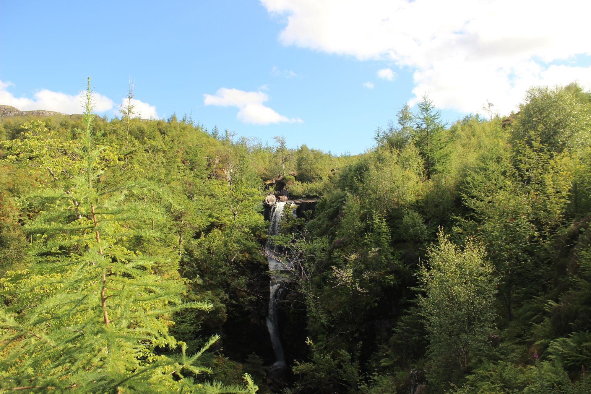
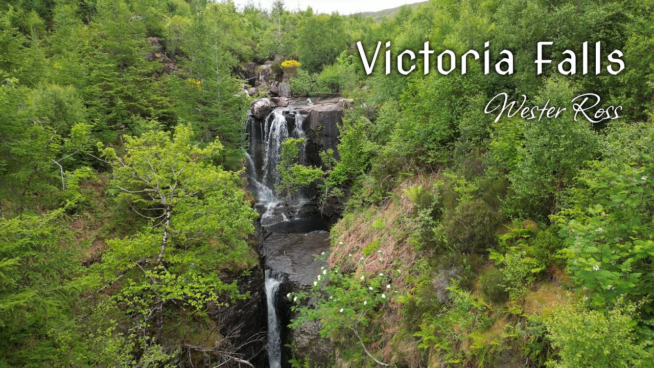
The waterfall system is defined by its two-tier descent, reflecting the underlying lithology and post-glacial drainage patterns of the region:
- The Abhainn Garbhaig Discharge: The cascade is the terminus of the Abhainn Garbhaig, a river system that acts as the primary conduit for water draining from the western slopes of Slioch. Because the river descends from a high-altitude catchment, it is highly reactive to localized precipitation, often transforming from a moderate flow to a high-energy torrent within hours of heavy Highland rain.
- Tiered Descent and Basaltic Influence: The waterfall operates across two distinct geological tiers. The river bed cuts through layers of resistant metamorphic rock and ancient sandstone, creating a tiered profile that forces the water into a concentrated, high-velocity stream. This morphology is characteristic of the "hanging valleys" frequently found throughout the Northwest Highlands, where smaller tributary streams fall into deeper, glacially-carved main basins.
- The Loch Maree Interface: At the base of the cascade, the water enters the deep waters of Loch Maree. The loch itself is a deep-water basin formed by severe glacial scouring. The confluence of the waterfall and the loch provides a critical habitat for native salmonid populations, which utilize the oxygenated, turbulent waters of the cascade as a key spawning-migration corridor.
The Trail Blueprint: Access, Viewing Logistics, and Path Stability
Accessing the Victoria Falls viewpoint requires adherence to established trail management, as the path transitions through highly sensitive peat-bog and woodland environments:
- Staging and Parking Infrastructure: The site is accessed via a dedicated roadside staging area located directly on the A832, a primary arterial route traversing the Wester Ross mountains. This parking facility provides a structured point of entry for travelers moving between the settlements of Kinlochewe and Gairloch. Because this is a high-traffic zone for long-distance touring vehicles, visitors must prioritize designated parking bays to ensure clear sightlines for the narrow A832 carriageway.
- The Viewpoint Trail Architecture: The path from the A832 parking area to the waterfall is engineered to manage high footfall while protecting the fragile peat-rich soils of the woodland floor. The route utilizes a well-defined, gravel-surfaced path that minimizes lateral erosion. At the terminus, a cantilevered viewing platform provides a secure, stabilized vantage point. This infrastructure is essential for visitor safety, as the immediate river bank is composed of slick, algae-coated rock faces and unstable mossy ground.
- Topographic Navigational Realities: While the path to the viewing platform is maintained for standard pedestrian access, the terrain immediately surrounding the waterfall is not a formal walking route. The steep, unstable slopes of the Garbhaig gorge are subject to frequent rock-fall and loose scree conditions; off-path exploration is strictly prohibited to prevent the degradation of the native woodland and to ensure walker safety.
Environmental Hazards and Biosphere Integrity
The Wester Ross coastal environment is a high-energy climatic zone where physical factors dictate visitor management and environmental health:
- Weather-Driven Flow Volatility: The drainage basin for the Abhainn Garbhaig is steep and narrow. During peak winter cycles or extreme maritime storm fronts, the water volume of the falls can increase significantly, causing localized bank erosion and sediment transport that alters the pool structures at the base of the cascade. Visitors should treat the river edges with extreme caution during high-flow conditions.
- Riparian Biodiversity Conservation: The area surrounding the falls is part of an ancient Caledonian pinewood habitat, characterized by relic stands of Scots pine and sensitive heather-bog micro-habitats. Walking outside of the marked trail leads to the compaction of peat soils, which take decades to recover. Maintaining the integrity of the trail is vital for the continued health of the local ecosystem.
- Sub-surface Stability: The rock structures defining the falls are subject to severe freeze-thaw weathering. This process loosens significant amounts of rock from the upper tiers of the waterfall. Even during calm weather, natural rockfall is a constant, though unpredictable, risk. Accessing the waterfall via the riverbed, rather than the designated platform, exposes visitors to high-risk areas prone to localized stonefall and vertical-slip zones.