



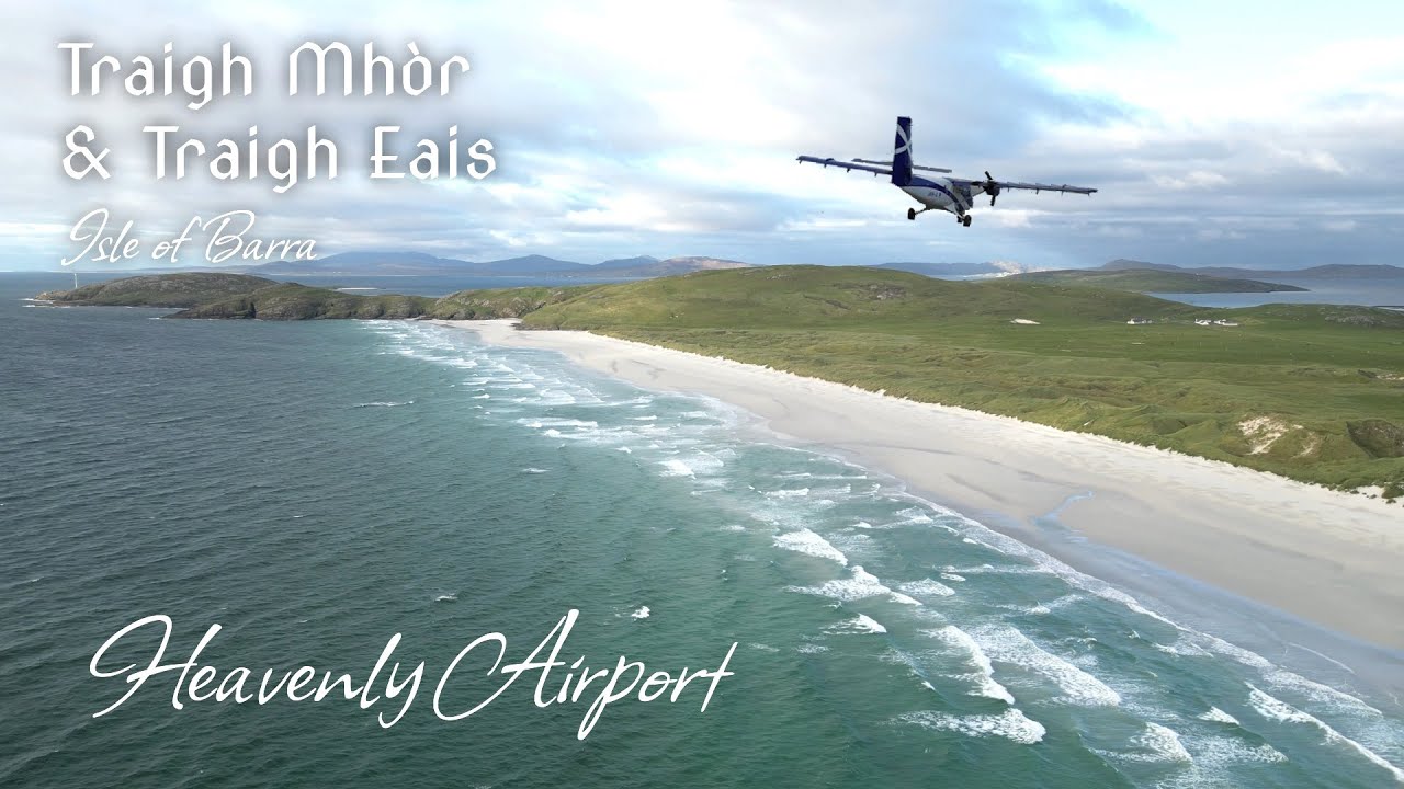

The Tidal Runway of the Hebrides: Navigating the Intertidal Sands, Flight Logistics, and Geomorphology of Traigh Mhòr
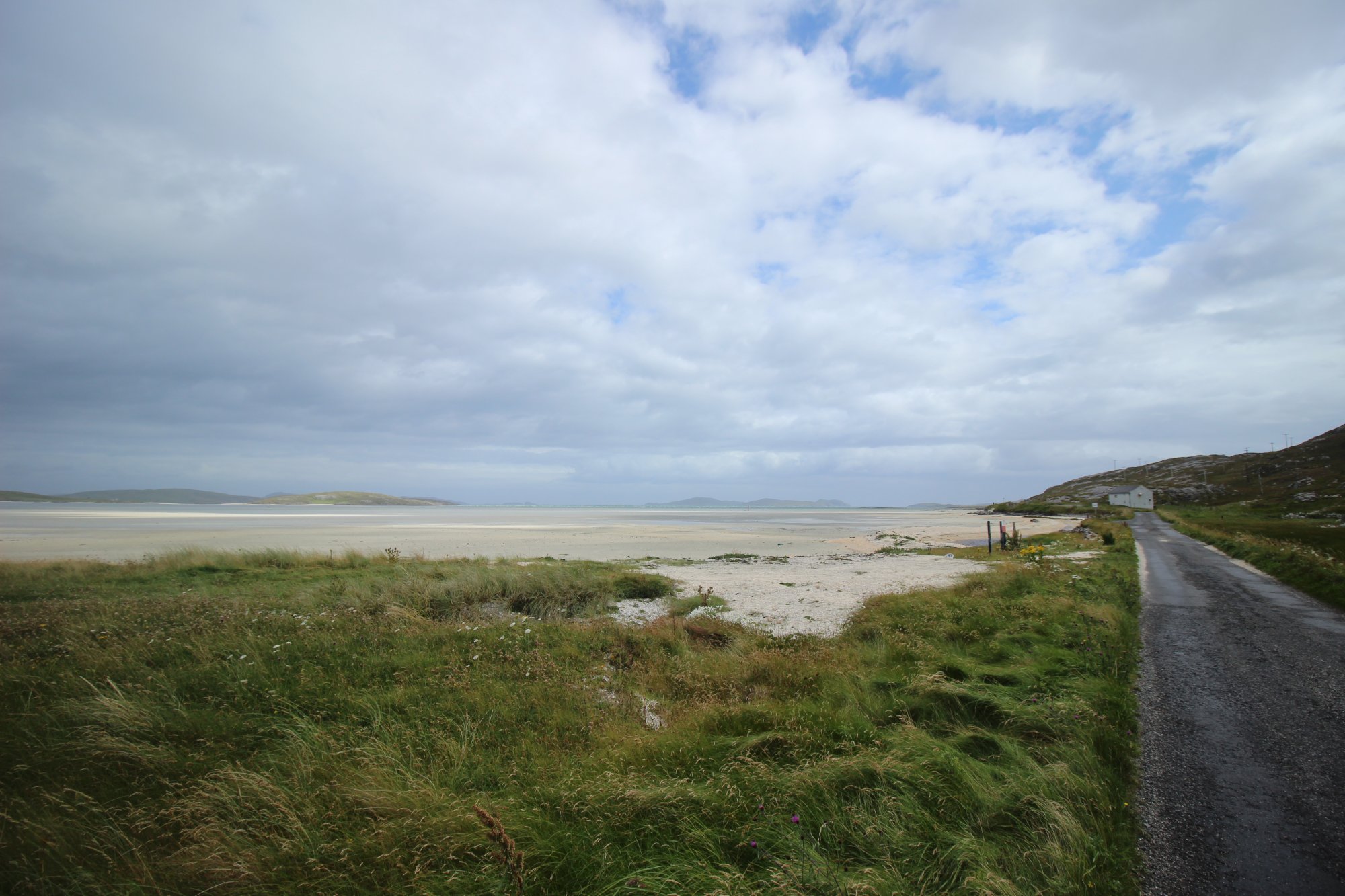
Sweeping across the sheltered eastern flank of the northern isthmus on the Isle of Barra, Traigh Mhòr—translated from Scottish Gaelic as "The Big Beach"—stands as one of the most geographically famous and infrastructure-unique coastal expanses in the world. Occupying the narrow neck of land that connects the main body of Barra to the northern Eoligarry peninsula, this vast intertidal plain of white cockleshell sand drops away at an exceptionally gentle angle. While its western neighbor, Traigh Eais, bears the full brunt of the open Atlantic surf just 200 meters ($650 ext{ feet}$) away across the sand dunes, Traigh Mhòr remains heavily protected from severe ocean swells by the surrounding islands of the Sound of Barra. This absolute flatness and geological stability created the ideal natural conditions for a world-renowned transportation marvel: the planet's only beach airfield managing scheduled commercial flight operations.
The Structural Blueprint: The Beach Runway and Aviation Dynamics
The physical footprint of Traigh Mhòr is shaped by a rare intersection of coastal geology and modern aviation infrastructure, dividing the intertidal bay into three key functional areas:
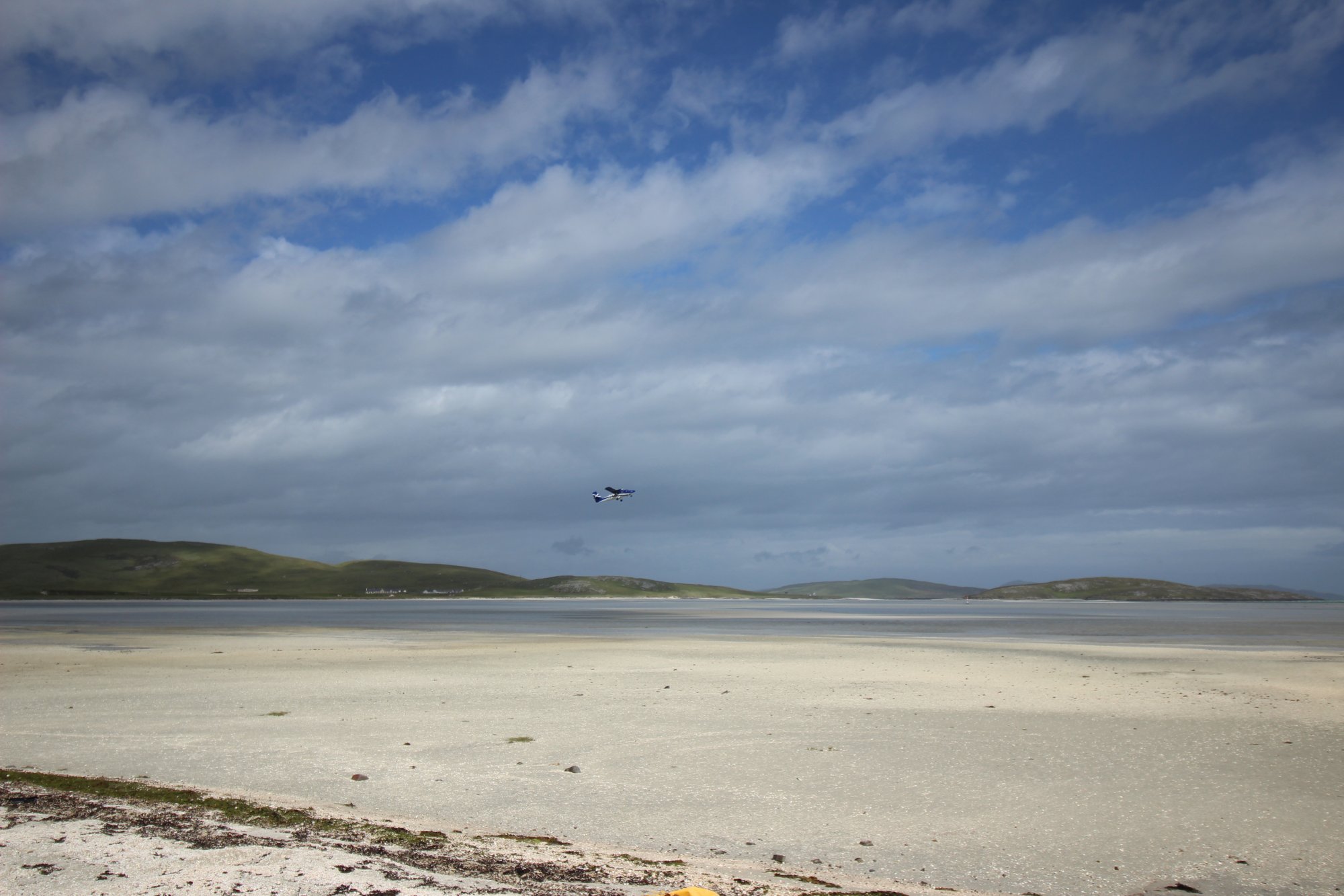
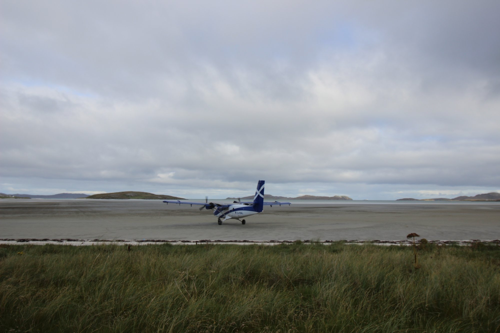
- The Three-Runway Sand Airfield: Traigh Mhòr is home to the legendary Barra Airport. The airfield layout consists of three distinct runways laid out directly on the hard-packed sand, marked at their boundaries by permanent wooden stakes. This unique triangular configuration allows lightweight Loganair Twin Otter aircraft to land and take off directly into the wind, regardless of shifting wind directions across the Minch.
- The Hydrology of Sand Saturation: The surface conditions of the runway flats vary radically depending on the daily movement of the sea. During low-tide cycles, the sand dries to a hard, firm crust. However, when flight schedules coincide with a receding or incoming tide, the runways retain a shallow film of seawater. Aircraft tires striking these saturated zones create dramatic, high-velocity plumes of sea spray, requiring specialized maintenance protocols to protect components from salt corrosion.
- Eoligarry Sands (Traigh Cille Bharra): Situated roughly half a mile north of the active airfield boundaries, this secondary sheltered strand faces northeast. It offers an expansive, peaceful alternative to the busy airport zone, defined by shallow, crystal-clear turquoise waters and rich machair meadows that bloom with native Hebridean wildflowers during the summer season.
The Trail Blueprint: Runway Restrictions, Cycling, and Island Access
Exploring the shores of Traigh Mhòr requires absolute adherence to strict aviation safety windows and local transport logistics:
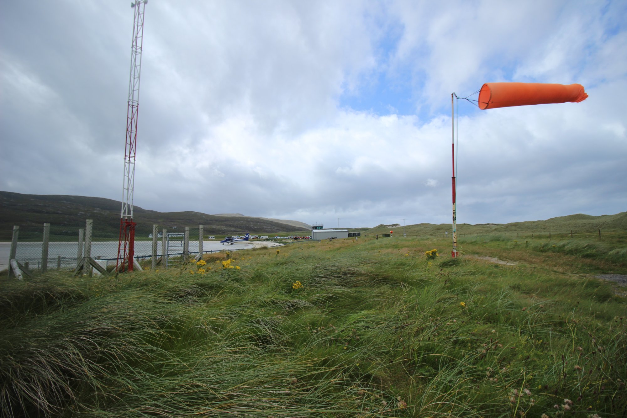
- Airfield Restriction Zones and Safety Windows: While Traigh Mhòr is a public beach, it functions as an active, strictly regulated airport during operational hours. Walking across the runways, gathering cockles, or wading in the inner bay is strictly prohibited whenever the airport's orange windsock is raised at the terminal building, signaling that aircraft movements are imminent. Once flight operations conclude for the day and the windsock is lowered, the beach completely reverts to a public space. Unmanned Aerial Vehicle (drone) pilots must strictly respect these operating windows, ensuring no drone flights take place while the airport airspace restriction zone is active.
- Island Exploration via Bicycle Logistics: Because Barra is a highly compact island, exploring the entire Eoligarry peninsula is easily managed without a car. Travelers arriving via the scheduled flights from Glasgow step directly onto the sand before entering the terminal, where bicycle hire services provide an efficient, self-sufficient means to tour the island’s single-track loop roads and historical sites like the ruins of Cille Bharra.
- Arrival Logistics and Parking Realities: Staging for the beach is managed directly via the primary Barra Airport terminal parking field. The parking area is free of charge and provides level, direct access to the edge of the sand flats. While Barra's remote Hebridean location protects it from extreme tourist overcrowding, parking spaces can become heavily congested around the scheduled flight arrival windows, making it advisable to coordinate general beach visits outside of flight times if seeking absolute solitude.
Marine Hazards, Rapid Tides, and Dune Conservation
The unique intertidal environment of the Barra isthmus creates distinct safety considerations that all beach walkers must actively manage:
- Rapid Tidal Inundation on the Sand Flats: When walking out toward the low-water mark on Traigh Mhòr, visitors must maintain constant situational awareness. Because the beach gradient is exceptionally flat, the incoming tide advances with surprising speed, flooding the shallow sand channels and depressions from behind rather than a single slow wall of water. This can easily cut off unaware walkers from the main mainland path.
- Dune Stabilization and Marram Grass Integrity: The massive, beautifully shaped dune system that separates Traigh Mhòr from the western surf of Traigh Eais is highly vulnerable to erosion. Clambering up the loose sandy faces of these hills destroys the fragile roots of the marram grass, which serves as the primary anchor keeping the entire isthmus from eroding into the sea. Walkers must strictly utilize the established gaps and livestock tracks when moving between the eastern and western coasts.
- Contrasting Surf Hazards of Traigh Eais: For visitors seeking traditional beach activities or watersports, a short 200-meter walk through the dune gaps leads to Traigh Eais. While Traigh Mhòr is restricted by airport usage and shallow waters, Traigh Eais offers over a mile of open Atlantic surf. However, its fully exposed western aspect creates powerful, high-velocity rip currents and strong undercurrents, meaning that swimming or surfing demands advanced open-ocean training and thick cold-water gear.